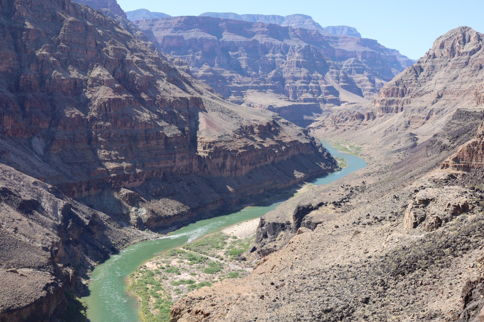
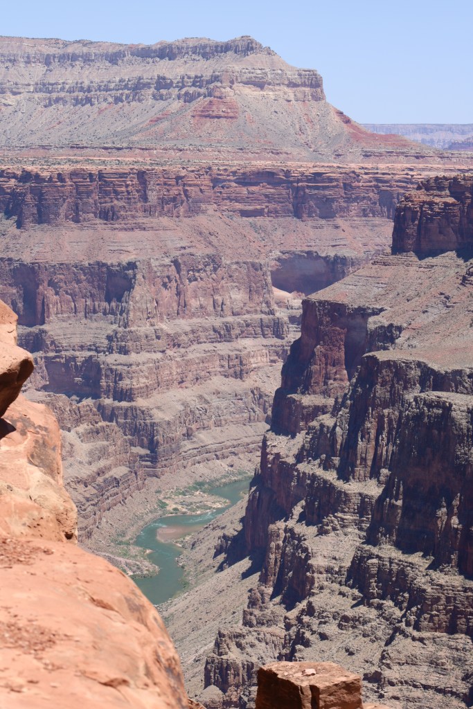
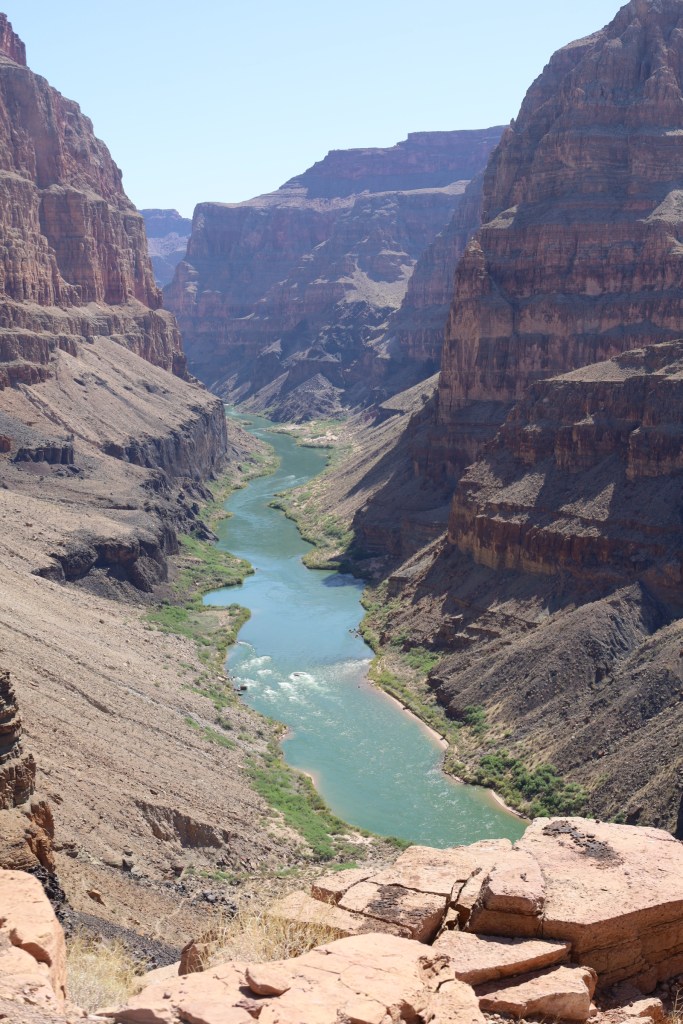
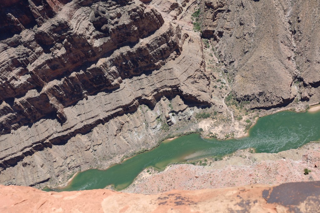
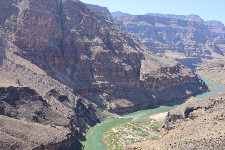
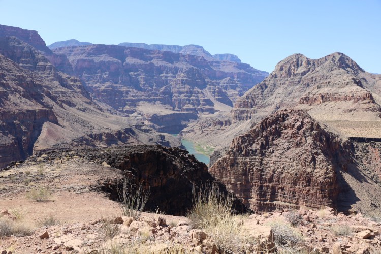
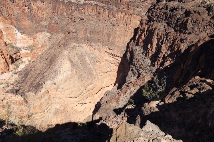
There are a few things in life that make you feel small and insignificant. One of those things is when you find yourself peering over the edge of the Grand Canyon into the great chasm carved over the millennia by a river. You realize the amazing power a single track of water can claim, creating such a magnificent spectacle. That is where I found my thoughts gravitating to as I gazed thousands of feet down a vertical cliff. But with any adventure, half of the fun was getting to this point.
We’ve spoken for years about making this trek from either St. George, Utah or Mesquite, Nevada to the North rim of the Grand Canyon. Originally, we scheduled this voyage last year with two other couples, but unfortunately, life intervened and we had to withdraw. We planned to stay at the Bar 10, a working cattle ranch/recreation lodge. Our trip was prepaid and they gave us a voucher for up to a year to use. Although we sought others to join us, it wasn’t convenient for any of our friends to do so, and we decided to do something we don’t typically advocate – going alone.
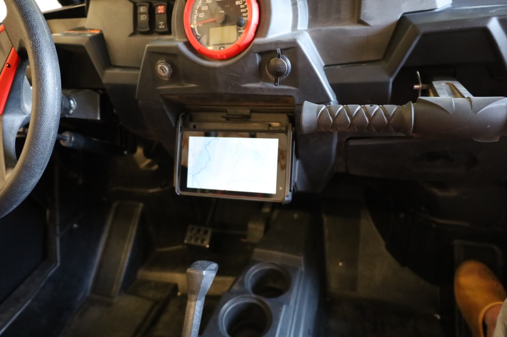
After spending two months earlier in Mesquite, Nevada and participating in numerous rides, I decided we really needed a GPS system. A quick trip to the Polaris dealer and I walked out of there shocked at the $2,500 price tag to have them install one. I started researching various Garmin, Tom Tom and Magellan devices to name a few, but couldn’t find what I wanted that would fit our riding style on BLM, and forest service trails. That was when I hit upon an application called Gaia GPS that can be downloaded on multiple devices in size anywhere from a phone to a laptop, reasonably priced for a yearly subscription, has numerous maps including satellite imagery, topographical, street maps and more; and best of all, no requirement to pay anything additional for map upgrades as they keep their maps updated and all you have to do is download them. I opted to run it on a 6 inch tablet that we mounted to our dash, holding it in place with a Ram tablet bracket.
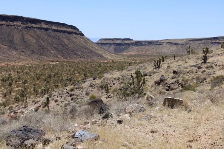
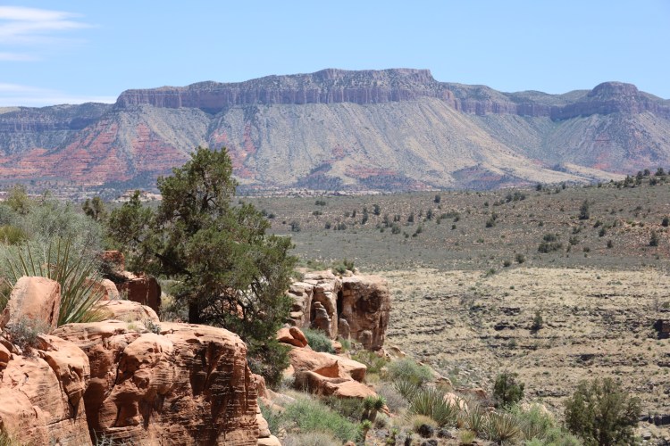
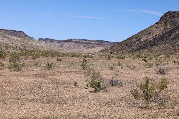
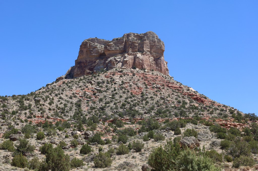
This was our beta test ride other than running around town, which could have been scary if it had failed. Overall, I was extremely pleased with how the application worked as it guided us through the Grand Canyon – Paraschant National Monument towards our destination of the Bar 10 Ranch. We saw beautiful cliffs, valleys and rocky stone mountains rising out of the desert and truly felt like adventurers as we marveled at the sites around us. In fact, I bought a t-shirt for the occasion that proudly states across the front “Not lost – Exploring” as my good luck mantra for this trip.
This is not to say we didn’t experience a learning curve on the functionality of our new device. The first leg of the trip was out of Scenic, AZ which is located just to the South of Mesquite, NV and over Lime Kiln Canyon, which we were familiar with. As we came to a 4-way intersection on the South side of the Canyon, there were two ranchers in their cotton plaid shirts and cowboy hats with a mini hoe digging up the road. We knew the Bar 10 lay to the South East of our current location and ventured a guess that we needed to go South. We drove approximately ¼ of a mile and realized we were off the trail the GPS laid out. Turning around we approached the intersection and turned East, as that was the next logical direction. Nope; still wrong. Turning around we now drove by the guys for a third time headed West. By this time, they were laughing at us and waved as we drove by yet again. Thankfully, this was the correct direction and we turned unto another road headed South a little while later.
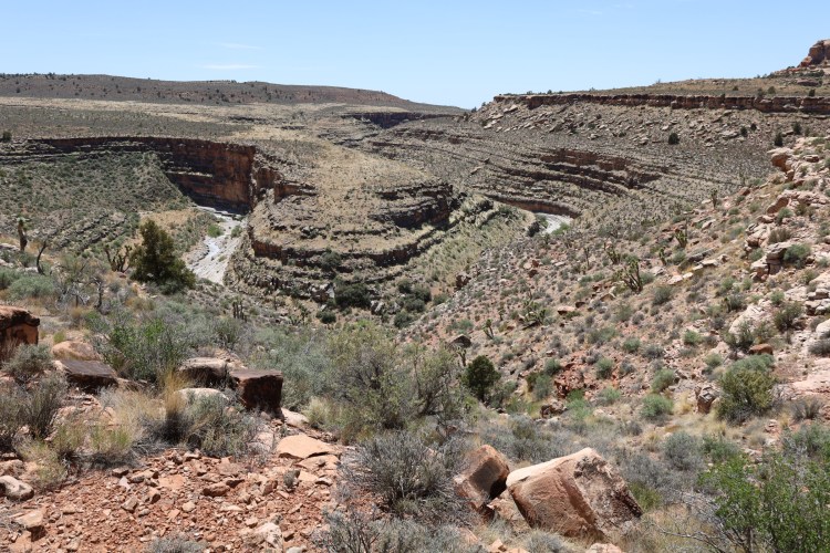
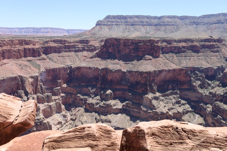
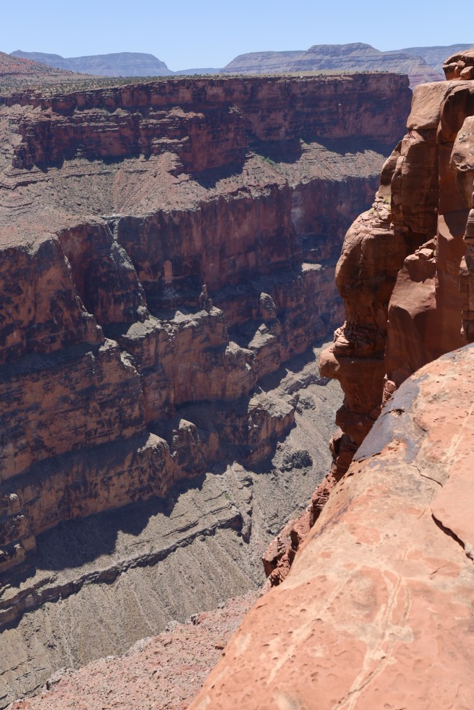
Grand Canyon at Tuweep Overlook
I’m not saying the route we took was the most direct or that the trails were the most well-traveled. In fact, I would say probably not. There are trails going everywhere and every direction within the Monument. When I plotted the path we would take, I was primarily looking for trails that went all the way through without dead ending. However, by doing so, we traversed down some smaller trails obviously not used as much, through washes and at one point had to squeeze through a gate that at first glance didn’t resemble a passage through. The biggest difficulty we experienced was the usable battery life of the tablet I purchased. Although advertised a full 8 hour expectancy, we averaged only about 5 hours. We then had to place a charger on it and the plug portion of it that goes into the outlet of the Rzr was only partially functioning. This is something we will definitely have to figure out and determine a better method. That being said, we were able to get it to work long enough that it enabled us to reach our destination.
When we began this journey, we estimated the drive to be approximately 60/70 miles. By the time it was done, we had managed to put 104 miles behind us. Another lesson learned on how to calculate the total mileage displayed on the GPS. We were comfortable doing 100 miles as the furthest ride we’ve accomplished previously was 148 in a single day and still had plenty of gas left. It did however, mean that I could no longer tease Charlie about his estimated 100 mile drive we took in Escalante, Utah a few years ago that turned into 148, since I now had a 60 mile ride turn into 104. I guess we’re even on that score.
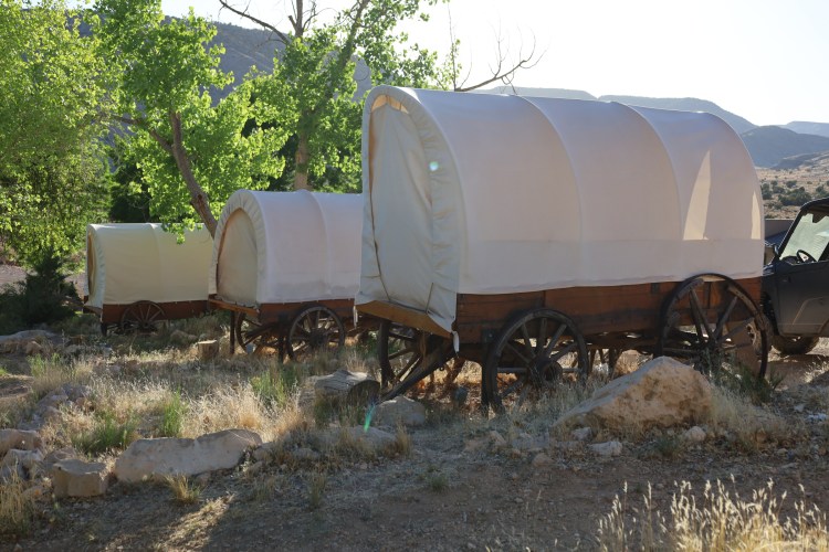
Arriving at the Bar 10 was a welcome relief. The atmosphere was enchanting and the staff running the lodge were friendly and helpful. The food they prepared was delicious. The first night we were treated to a dutch oven roasted beef, cheesy potatoes, more sides and killer brownies. The kind that are deep dark chocolate with chocolate chips and sprinkled with powdered sugar. Eewey, Gooey, and moist deliciousness! The beds were comfortable and I loved sleeping in the cool night temperatures outside in our covered wagon after looking at the starry sky free from any light pollution. There were so many stars visible, it was hard to pick out the big dipper as it was enshrouded with a myriad of stars around it.
The two overlooks into the Grand Canyon that we visited are the sites of the most active faults in the tectonic plates in Arizona. The Hurricane Fault formed Whitmore Canyon, Hells Hole and Hurricane Cliffs. Nine miles to the East, the Toroweap Fault formed the Toroweap Valley. At least seventeen lava flows resulted from the constant shifting of these tectonic plates creating the Uinakaret Volcanic Field. It is estimated the first volcanic eruption occurred 3.6 million years ago, with the most recent occurring 950 years ago. It’s easy to see the evidence of this activity by the amount of volcanic hillsides and fields as you drive through it. It is estimated that over 200 eruptions of lava occurred, many of which boiled down the hillside into the canyon and flowing into the Colorado River. At least seventeen of these flows damned the river between Toroweap and Whitmore Canyon, however the constant pounding of the river eventually eroded through the cooled lava blocks. With ice age river volumes several times larger than today, the turbulent rapids ripped apart the basalt until each damn was destroyed. Giant rounded boulders downstream bear testament to this. In 1869 John Wesley Powell penned “What a conflict of water and fire there must have been here! Just imagine a river of molten rock running down into a river of melted snow. What a seething and boiling of the waters; what clouds of steam rolled into the heavens?”
We met a group of people making the same trek as us via side by sides that reside in Idaho and spent the next day exploring together. Its great making new friends and we exchanged information with them as we departed. At night we sat around the campfire listening to the staff at the Bar 10 play guitars, harmonica and lute while singing. They read cowboy poetry/sayings to us and told us jokes. Cattle jokes; go figure.
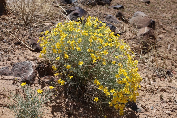
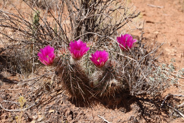
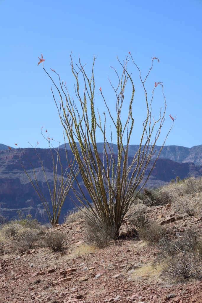
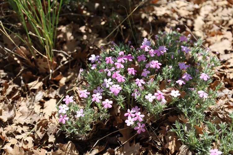
For the past two years the desert has received very little moisture. It was so dry that unfortunately there are very little desert blooms this year. I managed to capture a couple, but was sorry to see there weren’t more. The one thing I can share with you is how dusty it is. Beyond belief! So dusty that I was a strawberry blond by the end of our rides. One can only imagine how much dirt in your hair it takes to turn it from white to strawberry blond! Thank goodness the Bar 10 showers were wonderful, being plentiful in number and water pressure.
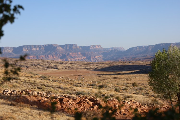
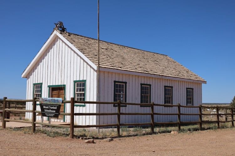
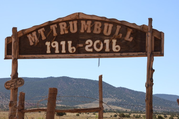
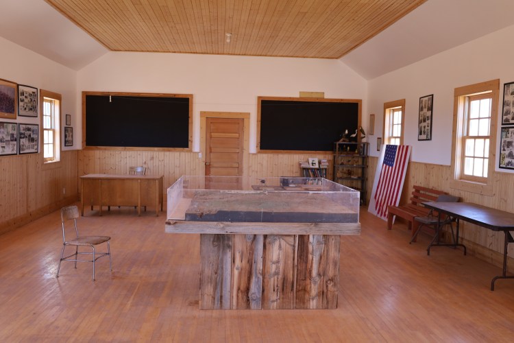
Life in the desert is hard. We saw several abandoned houses, dilapidated and in ruin. There is a school house with a plaque that spoke of settlers coming to this area in 1917 and building the Trumbull School House, naming it after a neighboring mountain. Each of the homesteaders received 640 acres for raising livestock and grew corn, beans, squash, wheat and other vegetables for themselves and to sell. The population reached a peak of 250 in the 1930’s. Changes in the climate made it difficult to continue farming and a lot of the farmers started raising sheep and cattle.
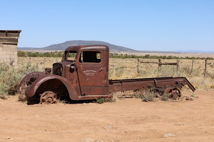
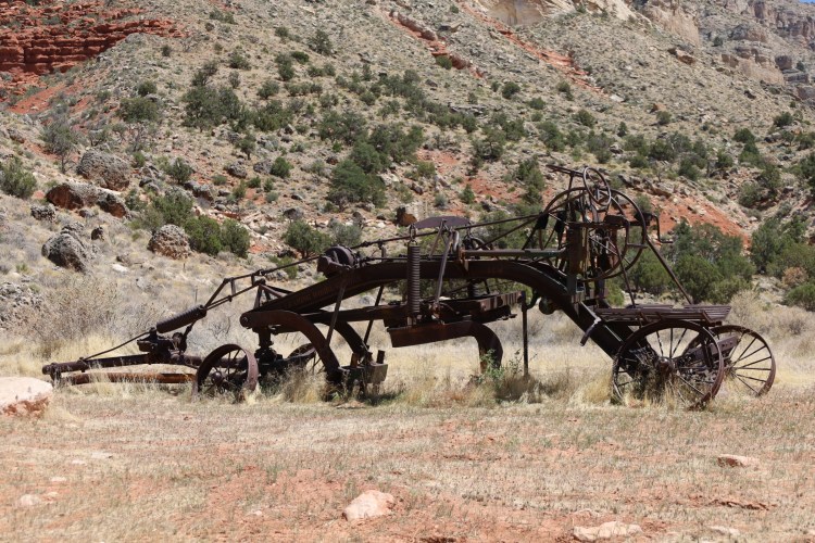
The school house was built in 1922 and also acted as their town hall, church and dance hall. The school bell rang for the last time in 1968 when there weren’t enough students to keep a full time teacher hired. The last full time resident left in 1984.
Thanks for reading about our adventure to the Grand Canyon. We thoroughly enjoyed it and encourage everyone to go if given an opportunity to do so. Our next adventure is a multi day raft trip down the Arkansas River in Colorado.

You did a great job of detailing our trip.
LikeLike
Nicely done, very informative. pictures are stunning.
How blessed are we to be able to see such wonders
Thank you so much
LikeLiked by 1 person
Thank you John. It’s not difficult to take nice pictures when viewing such spectacular sites.
LikeLike